The Best Parcel Data for Real Estate Professionals in Florida
Find any parcel in Florida by owner name, PIN, address, and more with our MapWise Explorer web app.
Trusted by 2,000+ Florida Real Estate Professionals

Real Estate Professionals Rely on MapWise to Work Quicker & More Efficiently.
Brokers, Realtors, Developers, Appraisers, Investors, Bankers, Surveyors, Engineers, Environmental Scientists and more use MapWise to:
- Browse interactive maps of Florida.
- Access statewide tax roll data and parcel maps sourced from county Property Appraisers.
- Search tax roll data by multiple criteria.
- View high-resolution aerials, flood zones, wetlands, soils, future land use, zoning, and more.
- Quickly research any area in the state.
- Create quality map graphics.
- Export data for further analysis.
MapWise GIS Map Viewer
The All-in-One Parcel Mapping and Research Platform for Florida Real Estate Professionals
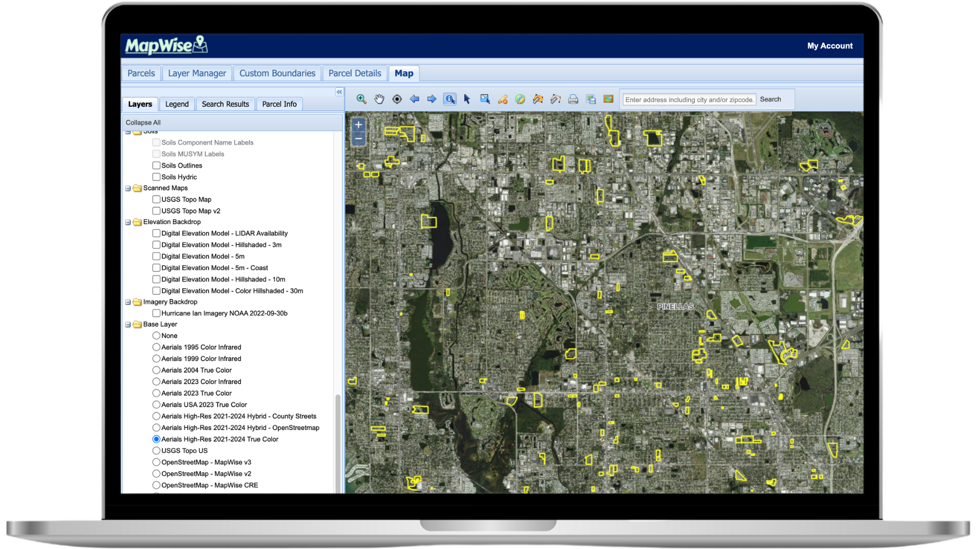
The GIS Map Viewer is your gateway to accurate parcel boundaries, ownership info, sales history, aerials, flood zones, zoning, and more—all layered into one fast and easy-to-use interface.
Whether you're analyzing land, preparing comps, or verifying development constraints, our GIS Map Viewer gives you everything you need at your fingertips.
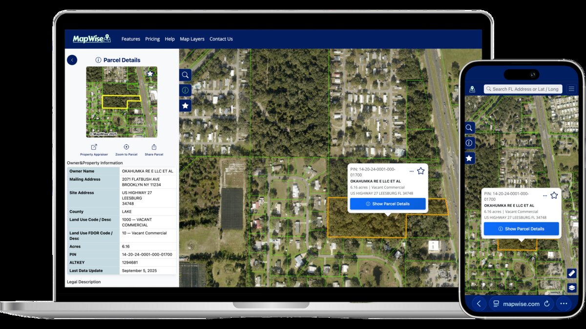
MapWise Explorer
Mobile Friendly Parcel Search and Property Information
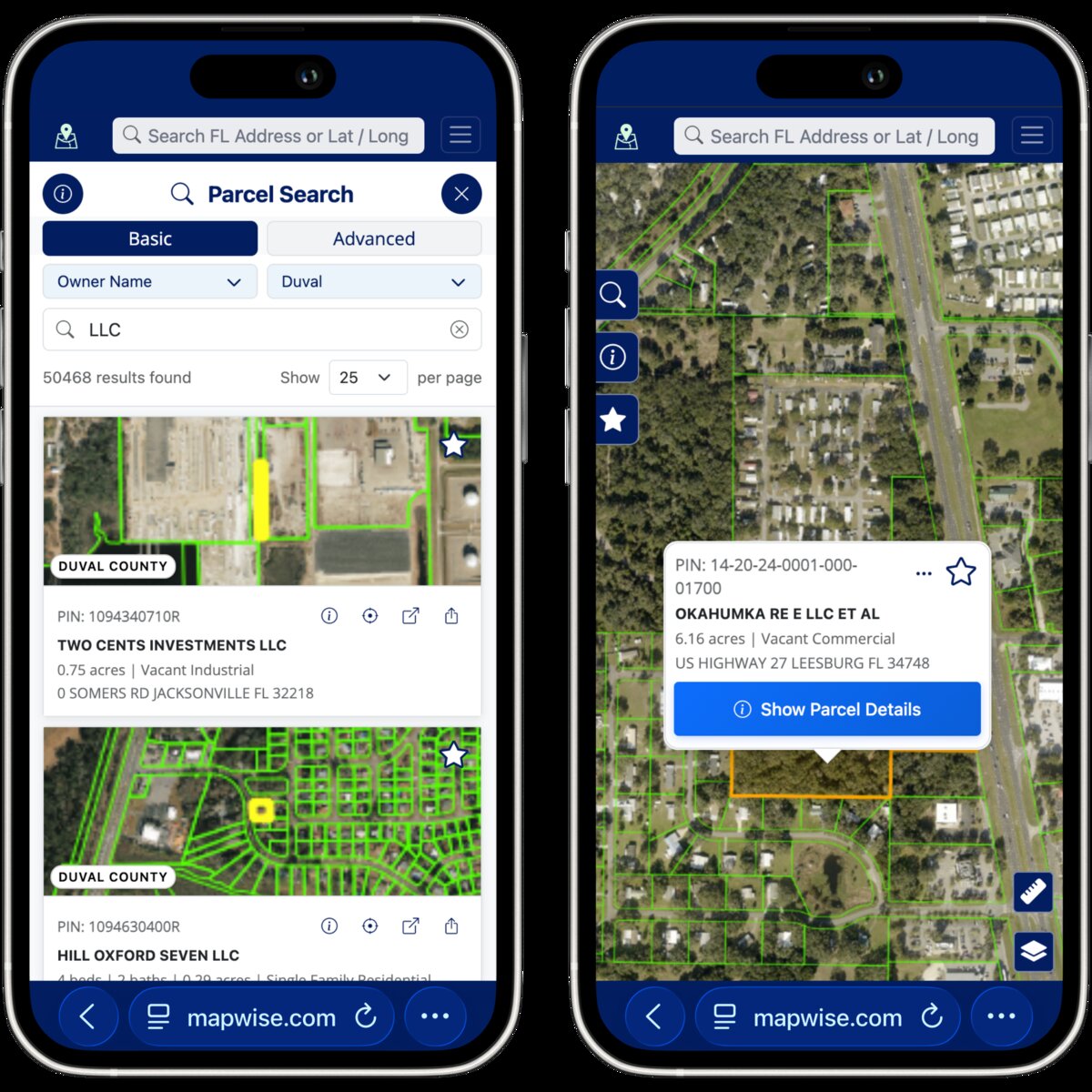
MapWise Explorer is a web app designed for real estate professionals to access and analyze Florida parcel data whether on the go or at your desktop.
Introduced in December 2024, Explorer is the first step in upgrading the legacy Map Viewer. Our current focus is on providing an improved workflow experience on your mobile device and desktop. Stay tuned for more updates and Get in Touch to provide your feedback.
Trusted By Real Estate Professionals for Over 20 Years.
Since 2001, leading organizations across Florida have depended on MapWise for accurate mapping data and easy-to-use research tools.
“I use MapWise a number of different ways in the process of acquiring land and have always found it to be an incredibly useful tool — from overlaying layers to determine buildable area, to checking zoning and land uses, to pulling resale comps for a full picture of value. I wholeheartedly endorse MapWise and feel it is the best value around as an all-in-one tool for your GIS needs.”
Larry Franks
President, BrightSky Residential
“I use this tool every day in my line of work. I can get accurate flood reports much quicker and easier than using other sites.”
Jay Markas
Statewide Commercial Insurance